Facts checked November 2026.
Quick answer: Lipulekh Pass is the high border pass between India and Tibet (China) at the top of the Vyas valley in Pithoragarh district, Uttarakhand. It is the Uttarakhand gateway of the government Kailash Mansarovar Yatra run by the Ministry of External Affairs. A Border Roads Organisation road of 80 km now climbs from Ghatiabagarh near Dharchula to the pass, reaching 17,060 feet.
| Where | Vyas valley, Pithoragarh district, Uttarakhand |
|---|---|
| Connects | India (Uttarakhand) with the Tibet region of China |
| Road | 80 km BRO road, Ghatiabagarh to Lipulekh, opened May 2020 |
| Road top | 17,060 feet (Defence Ministry figure) |
| Used for | Government (MEA) Kailash Mansarovar Yatra, Lipulekh route |
| Last season | First batch flagged off from Tanakpur on 5 July 2026 |
| Old Lipulekh viewpoint | About 18,300 feet; about 800 m walk from road end |
| Permit on Indian side | Inner Line Permit from SDM office, Dharchula |
Lipulekh is the only route to Kailash that starts inside Uttarakhand, and the same road that leads to the pass also brings pilgrims to Om Parvat and, on clear days, to a point on Indian soil from where Mount Kailash itself can be seen. This guide explains, in simple words, where the pass is, what it connects, how the road works, who can go there and what to expect.
This page is part of our How to Reach Adi Kailash and Om Parvat guide. Planning the yatra? See our Adi Kailash yatra packages.
Where is Lipulekh Pass and in which state?
Lipulekh Pass is in Uttarakhand, in the far north-east corner of Pithoragarh district, at the head of the Vyas valley. The old Lipulekh pass lies in the Vyas valley of Pithoragarh district (Deccan Herald). The pass sits on the border with the Tibet region of China, close to where India, Nepal and China meet. On the Tibet side, the first town pilgrims reach is Taklakot (Purang).
If you look at a map, follow the Kali river north from Dharchula. The road runs up the Kali gorge past Tawaghat and Budhi to Gunji, then on via Kalapani and Nabhidhang (the Om Parvat viewpoint) to the pass. For the full road plan from Delhi, Kathgodam or Tanakpur, see our guide on how to reach Adi Kailash, which shares the same road up to Gunji.
What does Lipulekh Pass connect?
Lipulekh connects India with Tibet. The Defence Ministry calls it the gateway to Kailash Mansarovar. The Ministry of Defence noted that on the Lipulekh route about 84% of the land journey is on Indian roads and only about 16% in China, while on the Sikkim and Nepal routes it is the other way round, about 20% in India and 80% in China (PIB, Ministry of Defence).
The Ministry of External Affairs says Lipulekh has been a yatra route since 1954 (IANS, MEA draw report). In earlier years yatris walked for many days from Tawaghat through Budhi and Gunji to reach it. Today the same stretch is covered by road.
How high is Lipulekh Pass?
The figure we can trace to an official source is the road height. The Defence Ministry says the BRO road rises from 6,000 feet to 17,060 feet at its top near Lipulekh (PIB). Published heights for the pass itself differ between books, maps and websites, so we do not quote a single “exact” number. The old Lipulekh viewpoint above the road is higher, at about 18,300 feet, as reported when it opened (Deccan Herald).
At these heights the air has much less oxygen. Even a short walk can leave you breathless. Rest a day at Gunji before going higher, drink enough water and walk slowly.
What changed when the Lipulekh road opened?
On 8 May 2020 the Defence Minister opened an 80 km road from Ghatiabagarh to Lipulekh, built by the Border Roads Organisation (PIB). Before this, the Lipulekh route meant a trek of about 90 km at high altitude. The Defence Minister said that with this road the yatra could be completed in one week, compared with two to three weeks earlier. In practice, the full government yatra, with the Delhi days and the parikrama in Tibet, still takes about three weeks.
| Item | Before May 2020 | After May 2020 |
|---|---|---|
| Last stretch to the pass | About 90 km trek | 80 km BRO road from Ghatiabagarh |
| Road height | No road; high-altitude trek | Rises from 6,000 to 17,060 feet |
| Time for the yatra (as stated by the minister) | Two to three weeks | About one week |
| Land journey on Indian roads (Lipulekh route) | About 84% (Sikkim and Nepal routes: about 20%) | |
| Building season for BRO | About five months a year, because of snow and cold | |
The road is cut into steep rock above the Kali river. The Ministry noted that the first 20 km is through near-vertical hard rock. Landslides and snow can close sections, especially in the monsoon and in early summer, so always keep a spare day.
How does the Kailash Mansarovar Yatra use Lipulekh?
The government yatra is organised by the Ministry of External Affairs with the Government of China. In 2026, 1,000 yatris were selected by a computerised draw for 20 batches of 50, split between Lipulekh and Nathu La, and the yatra ran from June to August (IANS). On the Lipulekh side, the Uttarakhand Chief Minister flagged off the first batch of 49 yatris from Tanakpur on 5 July 2026, and 10 batches were to leave Tanakpur over 18 days, with the Kumaon Mandal Vikas Nigam (KMVN) arranging reception, stay and other facilities (IANS).
In 2025, PTI reported that the first Lipulekh batch of 45 yatris stayed an extra day at Nabhidhang to get used to the height before crossing the pass into Tibet, and then went on to Taklakot and Darchen for the Kailash parikrama and Mansarovar (ETV Bharat / PTI). Batches return the same way.
| Stage | What happens |
|---|---|
| Delhi | Formalities and medical tests for selected yatris |
| Tanakpur | Flag-off point in Uttarakhand (2026) |
| Dharchula | KMVN base camp; last large town |
| Gunji and Nabhidhang | Rest and acclimatisation; Om Parvat darshan |
| Lipulekh Pass | Border crossing into Tibet |
| Taklakot (Purang) | First town in Tibet |
| Darchen and Mansarovar | Kailash parikrama and Mansarovar darshan |
For the full comparison of Lipulekh, Nathu La and the Nepal routes, including days, see our Kailash Mansarovar Yatra routes guide. To apply for the next government yatra, see our registration guide.
Can you see Mount Kailash from Lipulekh in India?
Yes, from a viewpoint near the old Lipulekh pass, on a clear day. In 2024 the Centre approved opening this pass to ordinary pilgrims, and the Pithoragarh district tourism office said it would open from 15 September that year. Visitors drive up from Dharchula and then walk about 800 metres from the end of the road to the viewpoint at about 18,300 feet, from where both Mount Kailash and Om Parvat can be seen (Deccan Herald). The first group of pilgrims saw Kailash from here on 3 October 2024, on an Uttarakhand Tourism package that used a helicopter from Pithoragarh to Gunji, with bookings through KMVN (Outlook Traveller).
This darshan does not need a passport or a Chinese visa, because you stay in India. It does depend on weather, permits and the season’s arrangements, which are announced each year. Our guide on whether Kailash is in India or China explains the difference between this viewpoint and the yatra into Tibet.
Who can go to Lipulekh, and what permit is needed?
- Crossing the pass into Tibet: only selected yatris of the government Kailash Mansarovar Yatra (Indian passport holders chosen in the draw).
- Om Parvat and the old Lipulekh viewpoint: Indian citizens with an Inner Line Permit, issued by the SDM office in Dharchula, together with a medical fitness certificate and police verification. See our Adi Kailash permit guide for the full document list.
- Foreign nationals: rules for this border belt are strict and change from time to time. Ask the SDM office in Dharchula before planning.
When is the Lipulekh road open?
There is no fixed opening date. The road is usually used from late spring to autumn. The government yatra crosses in June to August, the Adi Kailash and Om Parvat season has run roughly from May to October in recent years, and the high road is blocked by snow in winter. Snow and landslides can close the road even in the season, so keep spare days.
How do you plan an Om Parvat and Lipulekh darshan?
- Get a doctor’s fitness certificate and police verification at home.
- Reach Dharchula by road via Pithoragarh (from Kathgodam or Tanakpur railheads) and collect the Inner Line Permit.
- Go by 4×4 to Gunji and rest a night or two to get used to the height.
- Drive to Nabhidhang for Om Parvat, and to the old Lipulekh viewpoint when it is open.
- Visit Adi Kailash and Parvati Kund at Jolingkong on another day, then return to Dharchula.
Our Adi Kailash and Om Parvat Yatra from Dharchula follows this road. Call or WhatsApp +91 78178 98687, or write to shiva@yatratotemples.in, for dates and current permit rules.
Related guides: Kailash Mansarovar distance in km by route
Latest yatra updates
Frequently asked questions
Lipulekh Pass is in which state?
Lipulekh Pass is in Uttarakhand, in Pithoragarh district, at the top of the Vyas valley above Dharchula. It lies on the border with the Tibet region of China.
What is the height of Lipulekh Pass?
The BRO road reaches 17,060 feet near the pass, according to the Ministry of Defence. Heights given for the pass itself vary between sources. The old Lipulekh viewpoint is about 18,300 feet.
Which countries does Lipulekh Pass connect?
It connects India with the Tibet region of China. Pilgrims cross it on the government Kailash Mansarovar Yatra and reach Taklakot (Purang) on the Tibet side.
Can I drive to Lipulekh Pass?
Yes, the BRO road runs all the way, but private visitors need an Inner Line Permit and can only go as far as the permit allows. Most yatris hire a local 4×4 from Dharchula, because the road is narrow and rough in places.
Can I see Mount Kailash from Lipulekh without going to Tibet?
Yes, on a clear day from the old Lipulekh viewpoint, about 800 m on foot from the road end. It opened to pilgrims in 2024. Each season’s arrangements are announced separately, so check before you book.
How long is the Kailash yatra via Lipulekh?
The government yatra via Lipulekh takes about three weeks including the days in Delhi. Our routes guide gives the current day count and compares it with Nathu La and the Nepal routes.
Is Lipulekh open in winter?
No. Snow closes the high road in winter. Travel on this road is planned between late spring and autumn, and the government yatra runs in summer.
Do I need a passport to go to Lipulekh?
Not for Om Parvat or the old Lipulekh viewpoint, which are in India. You need the Inner Line Permit. A passport and Chinese visa are needed only if you cross into Tibet on the Kailash Mansarovar Yatra.
Sources
- PIB, Ministry of Defence: 80 km road to Lipulekh opened (8 May 2020)
- IANS: first Lipulekh batch flagged off from Tanakpur (5 July 2026)
- IANS: MEA draw selects 1,000 yatris (21 May 2026)
- Deccan Herald: Kailash darshan from old Lipulekh pass
- ETV Bharat / PTI: pilgrims enter Tibet through Lipulekh (10 July 2025)
Related guides
 How to Reach Adi Kailash and Om Parvat: Route, km, Hours
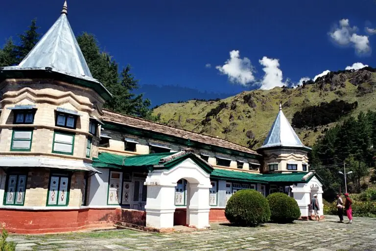 Narayan Ashram, Dharchula: History, How to Reach and Stay
 Gunji Village: Base Camp for Adi Kailash and Om Parvat
More on Adi Kailash and Om Parvat: Narayan Ashram, Dharchula · Gunji Village · Adi Kailash Parikrama Run 2026 · Pithoragarh Airport Flights · Adi Kailash vs Kailash Mansarovar · Adi Kailash Helicopter from Pithoragarh · Panch Kailash · Adi Kailash Trek and Parvati Kund · Adi Kailash and Om Parvat Permit · Adi Kailash yatra packages