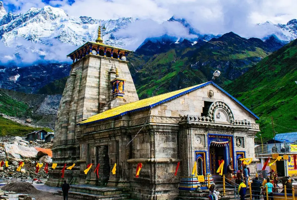
Quick answer: Kedarnath to Badrinath is about 230 km by road from Gaurikund, roughly 9 to 10 hours of driving via Guptkashi, Rudraprayag, Karnaprayag and Joshimath, as per the Uttarakhand government. First you walk the 16 km from Kedarnath down to Gaurikund. The Ukhimath–Chopta–Gopeshwar road works out, by estimate, to a similar or slightly shorter distance. Same-day helicopter charters also link Kedarnath and Badrinath via Phata.
−12°C / 3°C
−11°C / 4°C
−9°C / 4°C
Forecast estimate for this spot, not a thermometer reading at the temple; actual weather can differ. Always follow official IMD alerts. Weather data: MET Norway (CC BY 4.0), updates automatically; tap Refresh for the latest.
Updated for the 2027 yatra season (facts checked November 2026)
| Road distance | About 230 km, Gaurikund to Badrinath (Uttarakhand government figure) |
|---|---|
| Driving time | About 9 to 10 hours via Rudraprayag (government figure); plan a full day |
| Walking part | 16 km between Kedarnath temple and Gaurikund |
| Main route | Gaurikund – Sonprayag – Guptkashi – Rudraprayag – Karnaprayag – Joshimath – Badrinath |
| Other route | Guptkashi – Ukhimath – Chopta – Gopeshwar – Chamoli – Joshimath – Badrinath, about 205 to 230 km from Gaurikund (estimate) |
| Last stretch | Joshimath to Badrinath, 45 km, landslide-prone |
| Night driving | Hill roads on the yatra routes open 4 am to 10 pm only |
| Helicopter | Same-day Do Dham charters fly Phata – Kedarnath – Phata – Badrinath |
Kedarnath and Badrinath sit in neighbouring valleys separated by high mountains, and no road crosses the ridge between them. To go from one dham to the other you come down the Mandakini valley and then go up the Alaknanda valley, which is why the road journey takes a full day. This page explains that one journey in detail. For distances to Kedarnath from Haridwar, Delhi and other cities, see our Kedarnath distance guide.
This page is part of our Kedarnath Yatra Guide. Planning the yatra? See our Kedarnath yatra packages.
How far is Kedarnath from Badrinath?
The Uttarakhand government’s yatra registration portal gives the Kedarnath–Badrinath road distance as about 230 km, counted from Gaurikund, the last point vehicles can reach on the Kedarnath side. It puts the driving time at about 9 to 10 hours. On top of that, you have the 16 km walk between the Kedarnath temple and Gaurikund, which the same portal says takes about 6 to 8 hours going up. Coming down is usually quicker, but it is still a long morning on foot, by pony or by palki.
So in practice, Kedarnath to Badrinath is a two-day journey for most families: one day to come down from Kedarnath and reach a stop on the road, and one day to drive to Badrinath.
Route 1: via Rudraprayag and Joshimath (the main highway)
This is the route the government portal uses. It follows the Kedarnath highway down to Rudraprayag and then the Badrinath highway up through Karnaprayag, Nandprayag, Chamoli and Joshimath. It is the main national highway, with more towns along the way for fuel, food and medical help.
| Stage | Distance | How |
|---|---|---|
| Kedarnath temple to Gaurikund | 16 km | On foot, pony, palki or pithu |
| Gaurikund to Sonprayag | 5 km | Shared jeep |
| Sonprayag to Guptkashi | About 31 km | Road |
| Guptkashi to Rudraprayag | About 39 km | Road |
| Rudraprayag to Joshimath (via Karnaprayag, Chamoli) | About 111 km | Road |
| Joshimath to Badrinath | 45 km | Road |
| Total by road (Gaurikund to Badrinath) | About 230 km | About 9 to 10 hours of driving |
The Gaurikund–Sonprayag, Joshimath–Badrinath and total figures are official. Sonprayag–Guptkashi and Rudraprayag–Joshimath are worked out by subtracting published distances, so treat them as approximate. Stage times are not published officially; your driver will plan stops based on traffic and weather on the day.
Route 2: via Ukhimath, Chopta and Gopeshwar
Many drivers take the road from Guptkashi across the Mandakini to Ukhimath, then up through the forests of Chopta and down to Gopeshwar and Chamoli, where it joins the Badrinath highway. It avoids going all the way down to Rudraprayag and passes Ukhimath, the winter seat of Lord Kedarnath, and Chopta, the base for Tungnath.
| Stage | Distance |
|---|---|
| Gaurikund to Guptkashi | About 36 km |
| Guptkashi to Ukhimath | 13 km |
| Ukhimath to Chopta | About 20 to 45 km (published figures differ) |
| Chopta to Gopeshwar | About 40 km |
| Gopeshwar to Chamoli | About 3 km (worked out) |
| Chamoli to Joshimath | About 49 km (worked out) |
| Joshimath to Badrinath | 45 km |
| Total (Gaurikund to Badrinath) | About 205 to 230 km (estimate) |
Gaurikund to Guptkashi, Gopeshwar to Chamoli and Chamoli to Joshimath are worked out by subtracting published distances from Rishikesh. For Ukhimath to Chopta, the district’s own distances from Rishikesh suggest about 20 km, while other references give 45 km, so the total is shown as a range. Adding up the stage figures gives about 205 to 230 km, so the Chopta road is at most a little shorter than Route 1 in kilometres. It is a smaller hill road that climbs to about 2,900 m at Chopta and passes through forest, so it can be slower, and no official driving time is published for it. In return it is less busy and very scenic. The choice usually depends on road reports on the day: in July 2023, when rain washed away part of the Gauchar–Badrinath highway at Kamera, small vehicles were sent on other roads, including the Kund–Ukhimath–Chopta–Gopeshwar road. The reverse also happens; in August 2026 a section of the Ukhimath–Chopta road (NH-107A) near Tala sank after heavy rain and needed repairs.
Kedarnath to Badrinath by helicopter
There is no scheduled helicopter service between the two temples, but same-day Do Dham charters link them. For example, Pawan Hans, the government helicopter company, publishes a same-day package from Sahastradhara heliport in Dehradun that flies to Phata, shuttles to Kedarnath for darshan, returns to Phata and then flies on to Badrinath before returning. In its sample schedule, the Phata to Badrinath leg takes about 40 minutes.
- Charters carry up to five passengers within a total body-weight limit (300 kg on the Pawan Hans sample), and baggage is limited to a small handbag (2 kg each).
- Bookings are subject to confirmation by UCADA, the Uttarakhand civil aviation authority.
- Flights depend on weather and can be delayed or cancelled at short notice.
The regular Kedarnath helicopter shuttle from Guptkashi, Phata and Sirsi only flies to Kedarnath and back; it does not go to Badrinath. Read our Kedarnath helicopter booking guide for that service.
Distances from Haridwar, Rishikesh, Dehradun and Delhi
| From | To Gaurikund (Kedarnath road head) | To Badrinath |
|---|---|---|
| Haridwar | About 240 km | About 320 km |
| Rishikesh | About 220 km | About 300 km |
| Dehradun | About 250 km | About 330 km |
| Jolly Grant airport, Dehradun | About 250 km (to Kedarnath) | About 317 km |
| Delhi | About 450 km (worked out) | About 530 km |
Haridwar, Rishikesh and Dehradun figures are from the Uttarakhand registration portal; the airport and Delhi–Badrinath figures are from the Rudraprayag and Chamoli district sites. Delhi to Gaurikund is worked out from those figures. A circular Do Dham yatra from Haridwar therefore covers roughly 240 km up to Gaurikund, about 230 km across to Badrinath and about 320 km back down. See the whole Char Dham circuit on our Char Dham route map.
Night driving rules on hill roads
During the Char Dham Yatra, the Uttarakhand government allows vehicles on mountain roads only between 4 am and 10 pm. This window was set in 2022 (earlier it was 5 am to 8 pm), and in June 2026 the state again directed officials to enforce restrictions on the yatra routes from 10 pm to 4 am. In practice this means you must reach your night stop before 10 pm, so start early on the Badrinath day and do not leave Gaurikund late in the evening hoping to drive through the night.
Best time, road conditions and monsoon
Both temples open in spring (in 2026, Kedarnath opened on 22 April and Badrinath on 23 April) and close for winter in October or November. Kedarnath usually closes first, on Bhai Dooj; in 2026 its doors closed on 11 November. Badrinath usually stays open a little longer; in 2025, for example, Kedarnath closed on 23 October and Badrinath on 25 November. The 2027 opening dates have not been announced yet.
The road is easiest in the drier weeks before the monsoon and again after it. During the monsoon months landslides can block the highway for hours or days, and the 45 km from Joshimath to Badrinath is described by the state as landslide-prone. Keep a spare day in your plan, carry snacks and water in the vehicle, and follow police and SDRF instructions at check points. For month-by-month advice, read our guide to the best time for Char Dham yatra.
Registration on the Uttarakhand government’s yatra portal is required for both dhams; see our registration guide.
Suggested 2-day plan: Kedarnath to Badrinath
This is a suggested pattern, not a fixed schedule. Adjust it for your group’s walking pace, the weather and road reports.
- Day 1 – Kedarnath to Guptkashi. Have darshan at Kedarnath early in the morning, when queues can be shorter. Walk, ride or take a palki 16 km down to Gaurikund, take the shared jeep 5 km to Sonprayag, and drive about 31 km to Guptkashi (or 13 km more to Ukhimath) for the night. Rest well.
- Day 2 – Guptkashi to Badrinath. Start as early as the 4 am road opening and daylight allow. Drive to Badrinath either via Rudraprayag, Karnaprayag and Joshimath (about 195 km from Guptkashi) or via Ukhimath, Chopta and Gopeshwar (about 170 to 195 km from Guptkashi, estimate). Reach Badrinath for evening darshan and stay the night.
If anyone in your group finds the walk hard, consider an extra night at Kedarnath or Sonprayag before the drive. You can see our Do Dham Yatra (Kedarnath and Badrinath) by road from Haridwar or the Do Dham Heli Yatra. Call or WhatsApp us, or send an enquiry, for current dates.
Related guides: Badrinath distance chart
Latest yatra updates
Frequently asked questions
What is the distance from Kedarnath to Badrinath by road?
About 230 km from Gaurikund to Badrinath, according to the Uttarakhand government’s registration portal. Add the 16 km walk from the Kedarnath temple down to Gaurikund.
How many hours does it take from Kedarnath to Badrinath?
The government portal gives about 9 to 10 hours of driving from Gaurikund. With the walk down from Kedarnath, most families split it over two days.
Which route is better, via Chopta or via Rudraprayag?
By estimate, the Chopta route is similar or slightly shorter in distance. The Rudraprayag route is the wider main highway; the Chopta route is narrower, quieter and scenic. Choose on the day based on road and weather reports.
Can I go from Kedarnath to Badrinath by helicopter?
Yes, on a charter. Same-day Do Dham packages fly Phata – Kedarnath – Phata – Badrinath, subject to weather and UCADA confirmation. The regular Kedarnath shuttle does not fly to Badrinath.
Can I drive from Kedarnath to Badrinath at night?
No. Vehicles may run on the mountain roads only from 4 am to 10 pm during the yatra season, so plan to reach your stop before 10 pm.
Is Badrinath closer to Kedarnath than to Haridwar?
Yes. Badrinath is about 230 km from Gaurikund and about 320 km from Haridwar.
Where should I stay between Kedarnath and Badrinath?
Guptkashi or Ukhimath are the usual night stops after coming down from Kedarnath, as they are on both routes. Joshimath is the last large town before Badrinath.
Sources
- Uttarakhand Govt registration portal – Kedarnath Dham routes and distances
- Uttarakhand Govt registration portal – Badrinath Dham routes and distances
- District Rudraprayag – Kedarnath yatra (trek and Sonprayag–Gaurikund distances)
- District Rudraprayag – How to reach
- District Rudraprayag – Ukhimath
- District Rudraprayag – Chopta
- District Chamoli – Badrinath
- District Chamoli – How to reach
- District Chamoli – Gopeshwar
- Pawan Hans – Do Dham same-day helicopter package
- The Pioneer – Driving hours on mountain roads extended to 4 am–10 pm (2022)
- Indian Masterminds – Char Dham safety rules and night traffic restrictions (June 2026)
- The Tribune (PTI) – Rain washes away part of Badrinath highway; diversion via Chopta (July 2023)
- Amar Ujala – Ukhimath–Chopta road subsidence near Tala (August 2026)
- ThePrint (PTI) – Kedarnath portals to close on 11 November 2026
- India TV – Kedarnath reopening on 22 April 2026
- Deccan Chronicle – Kedarnath and Badrinath closing dates, 2025
- Wikipedia – Ukhimath; Chopta; Guptakashi; Jyotirmath (Joshimath)
Related guides
 Kedarnath Yatra: Complete Guide for Families
 Kedarnath Opening Date 2027 (Expected 9–12 May) and Closing DateKedarnath Distance from Haridwar, Delhi & Rishikesh
More on Kedarnath Yatra: Kedarnath Opening and Closing Date · Kedarnath Distance from Haridwar, Delhi & Rishikesh · Omkareshwar Temple Ukhimath · Kedarnath Height · Kedarnath Yatra FAQ · Kedarnath Hotels and Stay · Kedarnath Yatra from Haridwar · Kedarnath Darshan Timings · Kedarnath Yatra from Rishikesh · Kedarnath yatra packages